
Toronto is filled with landmarks, sights and photo-worthy spots! But have you ever wondered what some of your favourite areas in the city looked like 100 years ago? City of Toronto Archives is free to access and is filled with old photos of what Toronto looked like in the early 1900s.
We gotta say it’s pretty cool. Here is what some spots in Toronto looked like back then!
Recent Posts:
How bad is Toronto’s traffic? Here’s how it compares to other cities
Yes Chef! These are “The Bear” star & Canadian Chef Matty Matheson’s Toronto restaurants
Trinity College Gates
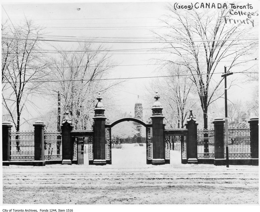
If you’ve been to Trinity Bellwoods Park then you’ve seen the iconic Trinity College Gates located at the park’s Queen Street entrance. This photo of the gates dates all the way back to 1916 – pretty sweet!
Bloor Street Viaduct
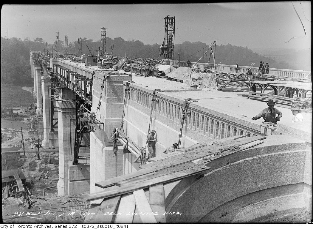
Chances are you’ve seen Bloor Street Viaduct as it’s Toronto’s longest bridge! The Prince Edward Viaduct System, commonly referred to as the Bloor Viaduct, is a truss arch bridge system connecting Bloor Street East with Danforth Avenue.
The roadway has five lanes (three eastbound and two westbound) with a bike lane in each direction, and the subway level connects Broadview Station in the east with Castle Frank and Sherbourne Stations to the west on Toronto’s subway Line 2. This photo is from 1917 during the Viaduct’s construction which lasted from 1914 – 1918.
Dundas Street and Roncesvalles Avenue
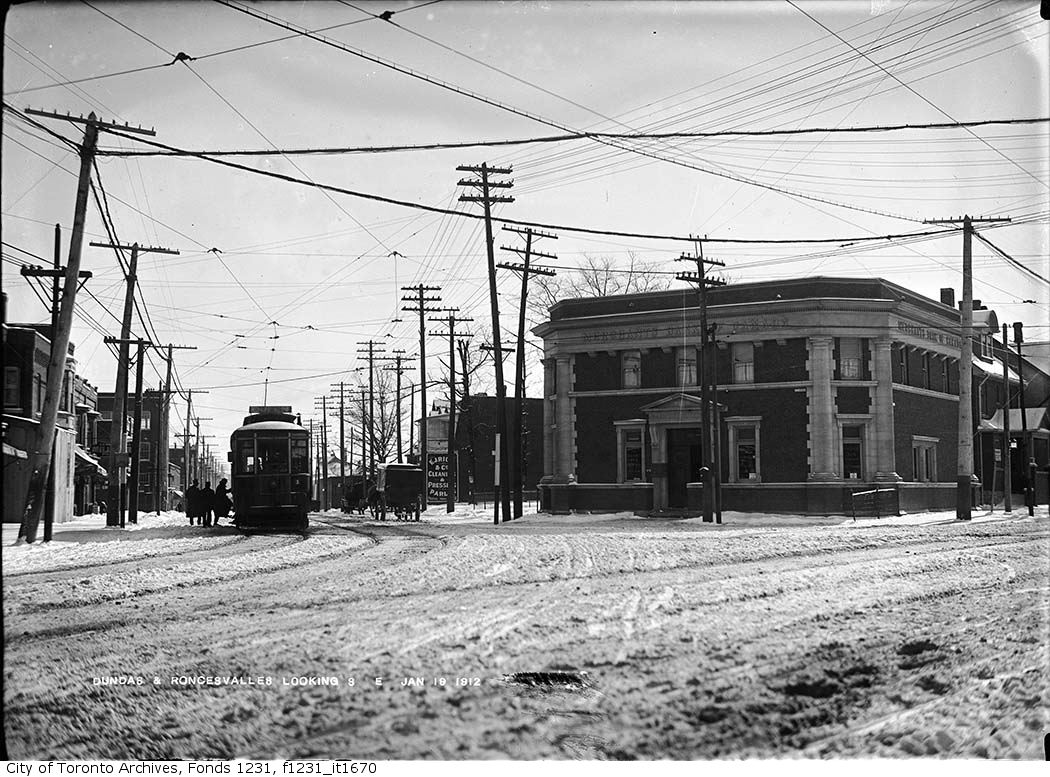
The neat thing about this photo from 1912 of the southeast view at Dundas Street And Roncesvalles Avenue is that nowadays it doesn’t look that much different! The only major change is that the Merchant’s Bank of Canada in this photo is now a Starbucks.
Distillery District
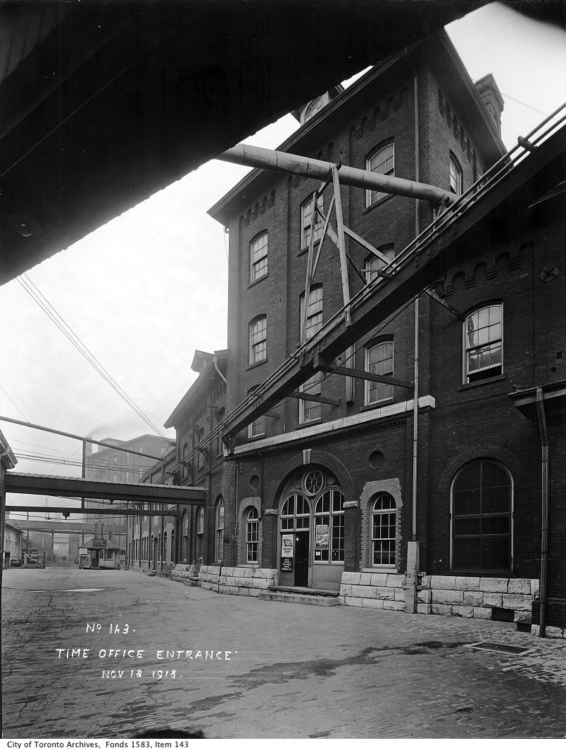
The Distillery District is a popular Toronto spot home to condos, shops, cafes and restaurants but back in the early 1900s The Gooderham and Worts Distillery was up and running! This photo dates back to 1918. Nowadays The Distillery District holds the largest collection of Victorian industrial buildings in North America, with over 40 heritage buildings and is considered a National Historic Site.
Old Union Station
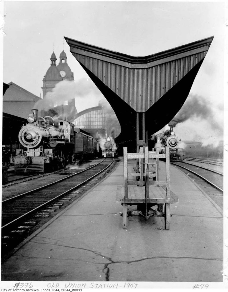
Union Station is one of the city’s most frequented spots and things sure have changed over the years! This photograph actually shows Old Union Station, which was located just west of the present Union Station station and was demolished in 1927.
Woodbine Beach
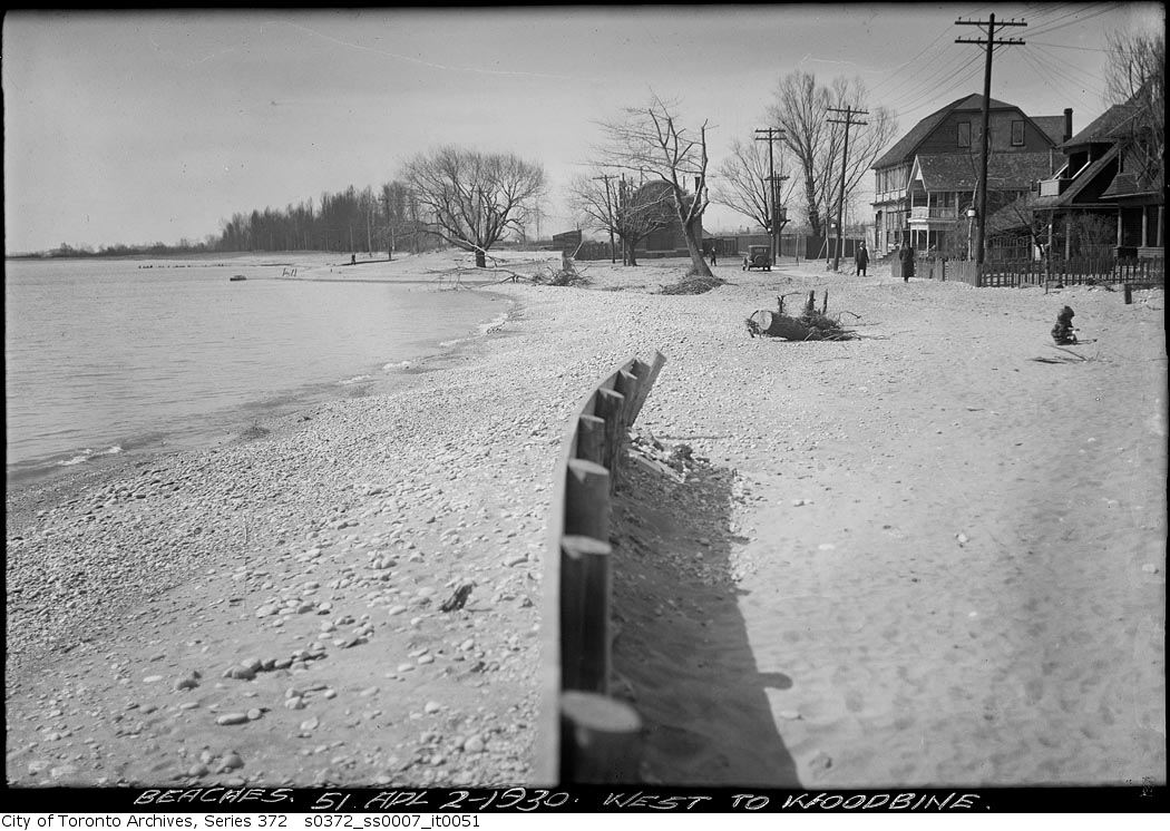
Torontonians spend lots of time at this spot during the summer months – Woodbine Beach. This photograph is a west-facing view of the beach from 1930 before there was a bustling boardwalk, food vendors and more!
North York
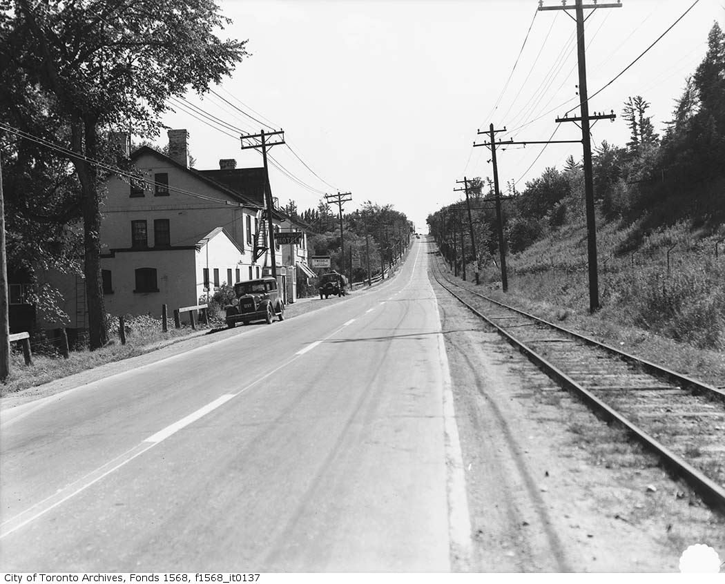
It’s hard to believe this is what one of Toronto’s busiest neighbourhoods, North York, used to look like! This south facing photo nearby the Miller Tavern from 1930 shows just how much things have really changed over the years.
Now that you know what these places in Toronto looked like in the early 1900s, why not check out what they look like today? Happy exploring!


