Winter storm watch in effect for Toronto & up to 15 cm of snow is expected

The chances of Toronto and pretty much all of Ontario, getting a white Christmas is a little higher thanks to the anticipated winter storm expected to hit the province this holiday weekend. A winter storm watch is now in effect for Toronto and here’s what you need to know.
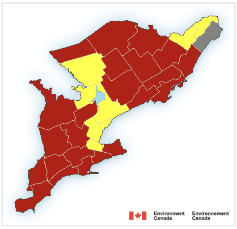
Environment Canada has changed its previous special weather statement to a winter storm watch for Toronto and they’re expecting extensive wind gusts, up to 15 cm of snowfall, and the potential of a flash freeze over the area.
Though Canadian weather tends to be unpredictable, meteorologists at The Weather Network have called the anticipated weather event, a ‘generational storm’. And it’s set to hit Ontario through the holiday weekend, starting early Thursday.
“Precipitation is expected to begin as rain or snow late this afternoon or early this evening before transitioning to rain for many areas tonight,” according to E.C. “Temperatures are expected to plummet on Friday morning leading to a potential flash freeze.”
Recent Posts:
12 Toronto restaurants serving dinner specials on New Year’s Eve
Ontario is about to get hit by a rare ‘once in a generation’ winter storm
Wind gusts of 90 to 100 km/h are also expected and with the snow, creating the possibility of ‘blowing snow’ to develop Friday Morning. If you are heading outdoors this weekend and commuting, make sure to bundle up as “very cold wind chills” are expected to develop on Friday and stick around into the weekend.
Environment Canada is now asking that people avoid travel if possible as conditions are expected to be hazardous due to reduced visibility in certain locations.
At the moment, all of Ontario is under a winter storm watch, warning or statement. There’s no need to panic! Make sure you’re warm indoors, away from the cold, and plan your weekend accordingly. If you need to head out, just be safe and wear lots of layers.


