Photo from Canadian astronaut shows the BC floods visible from space

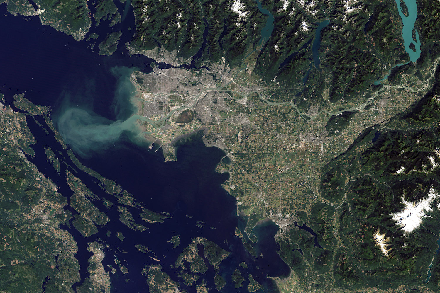
If you’re looking for a true bird’s eye view of the extent of the Fraser River flooding, then the Canadian astronaut Chris Hadfield has got it for you. On Tuesday, he shared a stunning image of Vancouver and the surrounding area from space, and the image is shocking.
With minimal cloud coverage, the incredible movement of topsoil into the sea is leaving a trail practically as big as Metro Vancouver. It’s so large, in fact, that it’s affecting the waters north of Vancouver, into Howe Sound and the Horseshoe Bay area…
Related Posts:
BC residents are stepping up to help each other during the floods & it’s so heartwarming (VIDEOS)
Here are some verified fundraisers to help victims of the BC storm
Fraser River flooding, from space. Amazing movement of topsoil into the sea. Stay safe, all. @NASA pic.twitter.com/k06r873PRa
— Chris Hadfield (@Cmdr_Hadfield) November 17, 2021
What’s more, an order image from NASA shows what the region normally looks like (at least, back in 2011). And side by side, we’d think it was some weird CGI editing to make the transformation look so amazing, if we didn’t know better.
So yeah, if you were looking for a wide lens view of the recent weather in Vancouver, this is about as good as it gets. Stay safe out there, folks!


