Snow & ice: Almost all of Southern Ontario under weather warnings as winter storm approaches


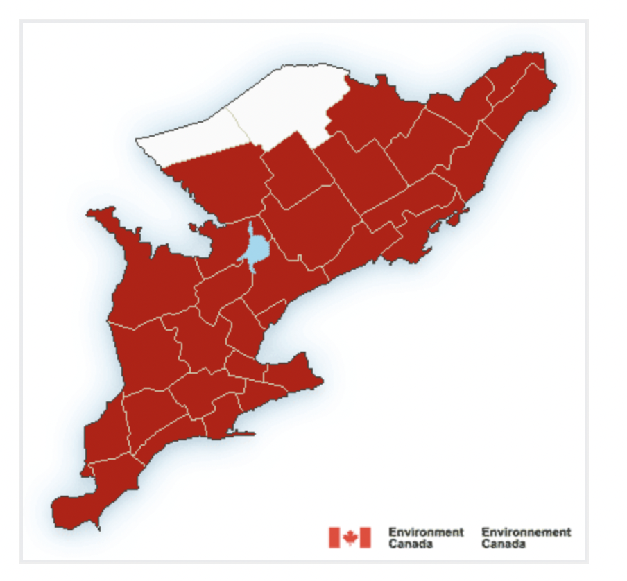
Almost every part of Southern Ontario is under a weather warning on Wednesday. According to Environment Canada, areas are under snowfall warnings, winter storm warnings, or freezing rain warnings, depending on the region.
For the City of Toronto, a winter storm warning is in effect, with the weather expecting to take a turn late today.
The warning states that the city can expect snow, heavy at times, and ice pellets. Toronto is expecting to see up to 15 cm of snow, although “accumulations may be lower in areas that experience a greater period of mixing with ice pellets and freezing rain.”
And yes, there is a risk of freezing rain, with “light ice accretion” possible as well. Expect the warning to last until early Thursday morning.
Recent Posts:
Toronto is under a winter storm watch & up to 15 cm of snow is expected
Canada is a step closer to getting a 200 km/h ‘high-frequency’ train going from Toronto to Quebec City
“Light snow will become heavy at times late this afternoon or early this evening. Snow will become mixed with ice pellets and may intermittently change over to freezing rain tonight. The wintry mix will taper off early Thursday morning to patchy freezing drizzle,” says Environment Canada.
And we will need to keep all the shovels and winter gear out for another day, because a possible wintry mix of precipitation is forecasted for Thursday afternoon.
A high impact winter storm will target millions across southern Ontario Wednesday and Thursday, with significant icing, power outages and hazardous travel expected. #ONStorm #ONwx
— The Weather Network (@weathernetwork) February 21, 2023
In other parts of of Ontario, such as Hamilton, it is expected to see heavy snow for the afternoon commute, then an ice storm tonight.
Mississauga and Brampton are expecting similar conditions as Toronto.
On the other hand, Ottawa is under a snowfall warning, with accumulations of 15 to 20 cm expected.
The Weather Network is calling this storm a “memorable and disruptive” one, adding that it can affect travel and power lines.
“Its easterly track over the Great Lakes, coupled with Gulf moisture and a winter versus spring-like temperature battle, all offer conditions ripe for prolonged, icy precipitation,” says Rachel Modestino, a meteorologist at The Weather Network. “Some regions may be impacted for over 20 hours, with dangerous winter travel expected for the Wednesday evening and Thursday morning commutes.”
It will be a messy drive out there, Ontario. Be safe!


