Toronto is under a winter storm watch & up to 15 cm of snow is expected

Oh, Toronto… winter is still here and it’s not going away any time soon. You may want to stay indoors this week as the city of Toronto is now under a winter storm watch and up to 15 CM of snow is expected.
Last week we shared that over 10 CM of snow may hit Toronto and it looks like it’s coming true. According to The Weather Network, about 10 to 15 CM of snow is expected with more trickling in throughout the week.
Environment Canada issued a winter storm watch due to a Colorado low bringing in some messy winter weather.
A “wintry mix of snow and ice pellets” could consume much of southern Ontario starting late Wednesday and into Thursday, according to the E.C.
Recent Posts:
Here’s everything coming to Disney+ in Canada this March
This rare floating home is up for sale in Toronto (PHOTOS)
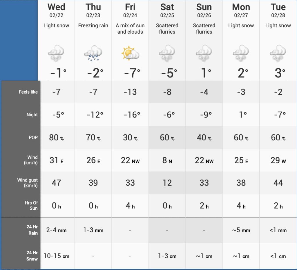
As usual, during winter storms, it could lead to hazardous winter travel conditions. Some areas may be hit with freezing rain while others with more snow.
“There remains some uncertainty for the exact location, timing, and accumulations of snow and ice pellets,” according to the E.C. “Warnings may be issued as the event draws nearer.”
For Toronto, we could expect snow and ice pellets that are heavy at times, a possibility of reduced visibility during moments of heavy snow and blowing snow, and the risk of freezing rain.
“Travel is expected to be hazardous due to reduced visibility in some locations. Surfaces such as highways, roads, walkways, and parking lots may become icy and slippery,” said the E.C.
“There may be a significant impact on rush hour traffic in urban areas.”
Though it looks like Wednesday we’ll see the worst of it, according to TWN, scattered flurries are expected into the weekend and into Tuesday with light snow.
As always, Canadian weather is unpredictable, especially in Toronto.
It’s probably safe to say that we’re ALL ready for Spring-like weather, though.


