
One winter storm just wasn’t enough! Ontario faced its first major winter storm of 2024 earlier this week and now another one is on the way for Friday.
The Weather Network warns that dangerous blizzard-like conditions are forecast from Friday night into Saturday and that snowfall totals could be significant in some areas of the province. There’s also the risk of extensive blowing and drifting snow, localized wind damage and power outages. This winter storm will have two differences from the last one that hit on Tuesday: colder air and stronger winds.
Recent Posts:
This snow tubing hill is the longest of its kind in Ontario
This Ontario skating rink dates back to 1872 & it opens for the season this month
Before Friday’s blizzard, however, TWN says that Thursday will still give a taste of what’s to come, sharing, “a weak clipper system from the U.S. Midwest will track through southern Ontario on Thursday, bringing with it a couple of centimetres of snow.”
Some areas will see up to 5 cm of snow, remaining south of Bracebridge and Bancroft, and moving to Kingston into the evening hours.
A massive and powerful winter storm is likely as we head into the weekend, and is forecast to undergo bombogenesis, rapidly strengthening as it tracks towards Ontario.
Significant snow totals are on the line. #ONStorm #ONwxhttps://t.co/umeSwT62ty
— The Weather Network (@weathernetwork) January 10, 2024
Then it’s time to brace for Friday and Saturday. According to The Weather Network, “Late Friday and into Saturday, another strong, colder system is forecast to bring widespread, heavy snow and blizzard-like conditions to the province.”
They say that late Friday afternoon is where a high-impact scenario may take place as millions of commuters attempt to get home in southwestern Ontario. Heavy snow and gusts between 60-80 km/h are expected and travel is not recommended.
As for the rest of the province, TWN says to expect a storm by midnight. Snowfall rates could reach 3-5 cm per hour across Ontario at that time, making for some treacherous travel through the night.
Snowfall will be heaviest through the overnight hours, continuing into Saturday morning for eastern Ontario, including Ottawa which will see around 20 cm of snow.
Areas such as Bancroft, and north of Peterborough can expect anywhere from 20-30 cm of snow from Friday into Saturday.
Colder temperatures this weekend across the province will help the snow stick around and not wash away, although some areas along Lake Erie and Lake Ontario are expected to see a rain/snow mix.
For areas that do transition to rain, less than 10 cm is likely. Toronto and the GTA can expect up to 15 cm of snow.
Sustained winds of 40-50+ km/h are likely for Toronto and the GTA as well, with gusts of 60-80+ km/h making visibility on the roads very poor.
And with snow, comes cold temperatures across the province for the rest of the weekend!
“Colder than seasonal temperatures will dominate starting Sunday, and continue into next week, as well. This will set up an extended lake-effect snow squall event of more than five days, as arctic air floods into the region,” shares The Weather Network.
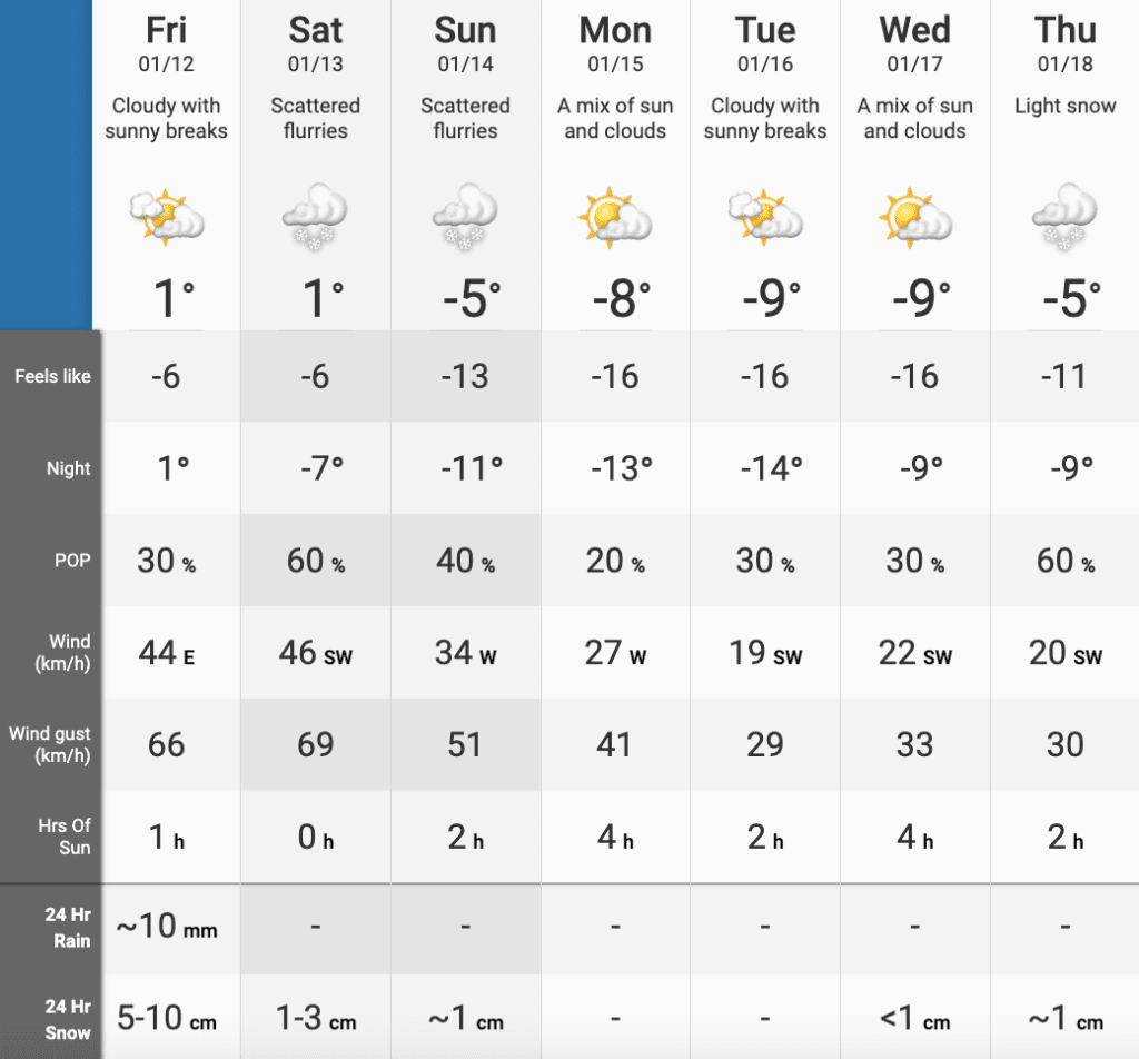
Temperatures in Toronto will get as cold as -14°C feeling like -16°C.
Sounds like winter isn’t going anywhere anytime soon!


