"Arctic air & gusty winds:" Metro Vancouver is under a weather statement ahead of cold spell

Heads up, Vancouver, we’re in for quite the “cold spell.” On the morning of Friday, January 27th, a special weather statement was issued for Metro Vancouver by Environment Canada, which forecasts that much of BC is about to get significantly colder.
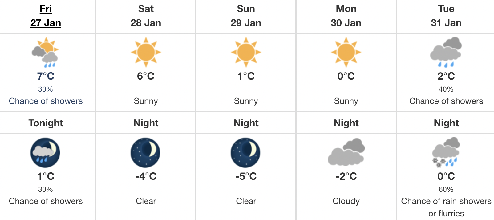
Starting Friday night, an “arctic air will invade BC,” bringing a swift end to our mild January. The temperature shift? Around 5 to 10 degrees below normal.
Northern BC coastal areas, in particular, will experience a rapid drop in temperatures, accompanied by gusty winds. So prepare yourselves for some extreme wind chill over the next few days!
In Vancouver, expect the temperature to be -4°C by Saturday night, and even colder on Sunday night.
Recent Posts:
This popular two-day music festival is returning to Metro Vancouver & the lineup is insane
14 delicious spots for cheap breakfast in and around Vancouver
According to Environment Canada, a few days of outflow winds are expected through the coastal valleys of Terrace, Prince Rupert, Kitimat, and Bella Coola beginning Saturday morning. These winds will then spread to the Sea to Sky area and Fraser Valley on Saturday.
In addition to the City of Vancouver, the statement is in effect for Burnaby, New West, the North Shore, Coquitlam, Maple Ridge, Surrey, Langley, Richmond, and Delta.
When will it get warmer again? While that answer remains less certain, we should see a gradual rise in temps by late next week, according to the statement.
So, it’s time to layer up again, and potentially break out your snow shovels this coming week.
Stay warm, Vancouver!


