Special weather statement issued for Vancouver & up to 15 cm of snow is expected

It looks like Vancouver is shifting to winter weather rather early this year – and we’re in for a ‘cold awakening’ this week. Last week, The Weather Network forecasted up to 10 cm of snowfall, and now, that number has jumped to 15 cm. Here’s a look at the frosty, colder weather we have in store.
According to a special weather statement by Environment Canada, Metro Vancouver is getting “strong winds, sub-zero temperatures, and cold windchill” starting Tuesday, November 29th. Not only will it be cold, Tuesday is when the Weather Network is showing up to 15 cm of snow. Basically, splurge on what’s missing from your winter wardrobe ASAP, because you’ll need all the layers you can get.
Recent Posts:
This popular winter terrace with holiday lights is returning to Vancouver next month
A huge Christmas festival with over one million lights is coming to Langley next month
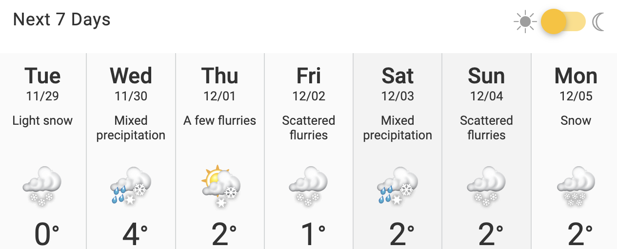
Vancouverites can expect to see snow flurries as soon as Tuesday afternoon, followed by snowfall with “significant accumulations” throughout the evening. The statement says that the snow will likely transition to rain overnight, which means winter ‘slush’ and “poor travel conditions” are inevitable.
With scattered flurries and “mixed precipitation” forecasted for the rest of the week, it’s not exactly sledding weather quite yet. But considering how early the season has started, we’re sure we’ll get there.
The largest amount of snow this week is predicted to fall on Tuesday, with the next significant snowfall forecasted for Monday, December 5th.
Prepare yourselves and stay warm, Vancouver!


