There are now 18 'new' neighbourhoods inside of Toronto

Little known fact about this great city of ours: we’re made up of social planning neighbourhoods. What are these neighbourhood profiles, you ask? Well, they were developed in the late 1990s and they’re basically a way to understand and interpret the social demographics of any given area.
Since the 1990s, there have been 140 total sections within Toronto. Essentially, the city is divided into sections on a map cataloging all the socio-economic changes that go down. The info is then used by city officials to help make local planning as meaningful as possible. The info is compiled with Statistics Canada and can be viewed by the public here.
Related Posts:
10 virtual Canadian events you should check out this spring
Walmart is closing some stores across Canada but significantly revamping others
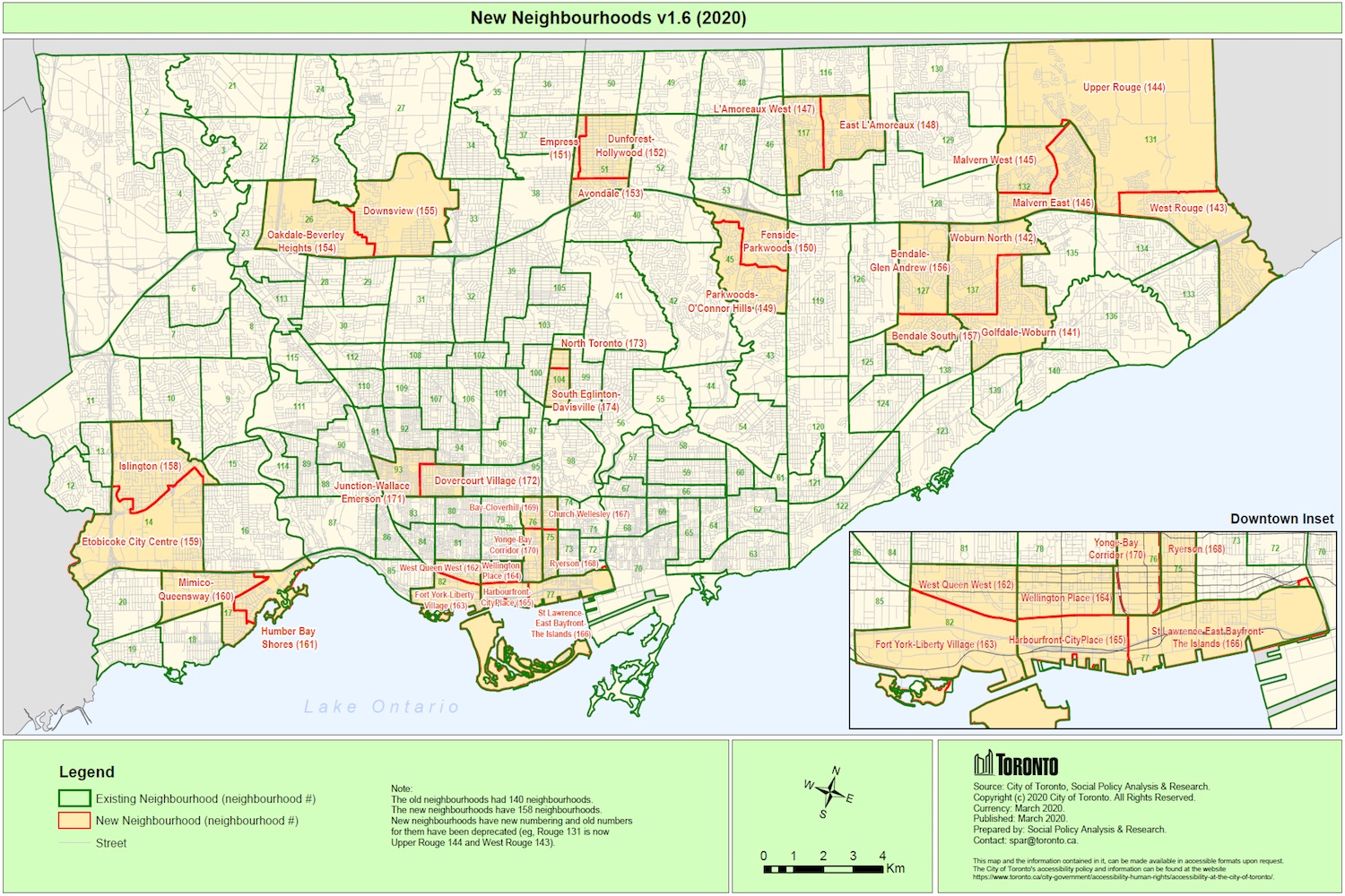
Well, now changes are underway for Toronto’s Neighbourhood Profiles. The social planning sections are going to be increased from 140 to 158. This will allow for more specificity in city planning and more useful improvements to each area. The map above shows the locations of the new neighbourhoods, their split lines, and their new names.
What’s important to note is that the outer boundaries of each neighbourhood will not be changing. The differences in the new map are splits to existing areas. That’ll help keep all the data consistent for those who are analyzing it over time.
The 158 new neighbourhoods were publicly announced in early 2021. You can read more about Toronto’s neighbourhood profiles right here.


