It’s snow joke: Toronto is getting hit with ‘significant’ snowfall this week

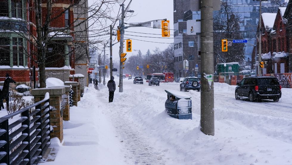
Brace yourselves, friends! Environment Canada is predicting a big bout of snow in Toronto this week and has issued a special weather statement to give locals a chance to prepare.
According to the weather authority, “significant snowfall” is possible this week, beginning late on Wednesday and continuing into Thursday.
“Snowfall accumulations of 10 to 15 cm are possible, with locally higher amounts of up to 20 cm,” says the statement.
Heavy snow could cause reduced visibility and will make travel difficult as it accumulates on roads and sidewalks.
The storm will sweep across southern Ontario thanks to a “Texas low” from the south, says Environment Canada.
Recent Posts
Toronto’s new upscale steak house is opening soon & it’s hiring
11 of the biggest concerts coming to Toronto this February
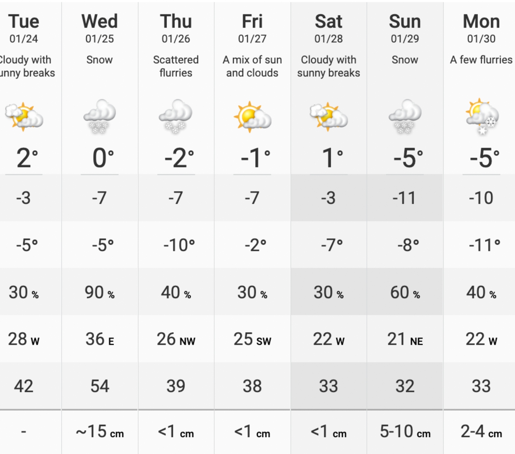
Small amounts of snow will continue to fall throughout the week in Toronto, followed by another 5 to 10 cm on Sunday, January 29th, according to The Weather Network.
Temperatures will also take a steep dive as we transition from January to February.
The Weather Network’s current forecast shows bitter cold heading our way in the first weekend of February, feeling like -14°C and -16°C on February 4th and 5th.
Overall, Ontario is in for a near-normal and sometimes colder-than-normal winter this year, according to The Weather Network’s official winter forecast.
However, there’s some good news for those who want some relief from the cold and snow in Toronto.
In February, “winter will take a break at times with periods of mild weather” in southern Ontario, said Chief Meteorologist Chris Scott in the winter forecast.
An “extended thaw” could take place in southern Ontario later this winter, but the season will also bring “a messy mix of snow, ice, and even rain at times,” and precipitation levels will likely be above-normal.
But. before any mild weather comes our way, we will need our shovels and warmest boots for the storm ahead.
Lilly Paltsev
Regional Editor, Toronto – Lilly is an editor with over five years of experience in local news and digital publishing. Having lived in Toronto her whole life, she’s always aware of what’s new in the city. She’s everyone’s go-to resource for the best things to do. Her mission is to make Curiocity’s readers feel excited about where they live and to infuse the world with positive vibrations.
Read articles


